


Precio FOB
Obtener el precio más reciente1846 ~ 2086 USD / Set ( Negotiable )
|1 Set Minimum Order
País:
China
N º de Modelo:
PQWT-S500
Precio FOB:
1846 ~ 2086 USD / Set ( Negotiable ) Obtener el precio más reciente
Lugar de origen:
Hunan, China
Precio de pedido mínimo:
1846 per Set
Cantidad de pedido mínimo:
1 Set
Detalle de embalaje:
Packed in Alumium Specialized flight Box + Carton
El tiempo de entrega:
Express shipping, delivery time around 5~7 working
Capacidad de suministro:
300 Set per Month
Tipo de pago:
Other, PayPal, Western Union, T/T
Grupo de productos :
Persona de contacto Nicole
Changsha, Hunan
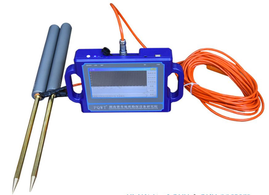
PQWT-S**0.**0M automatic mapping water detector is based on the Earth's electromagnetic field as the field source, based on the difference in the conductivity of different underground geological structures, and by studying the variation law of the electric field components at different frequencies to study the geological structure and changes, to find groundwater resources by scientific method. Changes in geological structure are displayed in real-time through multiple curves. Automatic form mapping geological profile by one key operate easily, get rid of complicated computer graphics. The site can quickly understand the geological structure through the automatic mapping curve and profile, and analyze specific information such as aquifers, fractures, faults, and caves. The instrument is widely used in the rapid analysis of geological structure changes in different terrains such as plains, hills, mountains, plateaus, and basins to determine well locations, aquifers, and aquifer depth.
| País: | China |
| N º de Modelo: | PQWT-S500 |
| Precio FOB: | 1846 ~ 2086 / Set ( Negotiable ) Obtener el precio más reciente |
| Lugar de origen: | Hunan, China |
| Precio de pedido mínimo: | 1846 per Set |
| Cantidad de pedido mínimo: | 1 Set |
| Detalle de embalaje: | Packed in Alumium Specialized flight Box + Carton |
| El tiempo de entrega: | Express shipping, delivery time around 5~7 working |
| Capacidad de suministro: | 300 Set per Month |
| Tipo de pago: | Other, PayPal, Western Union, T/T |
| Grupo de productos : | PQWT-S series water detector |


