Precio FOB
Obtener el precio más reciente|
1 Set Minimum Order
País:
China
N º de Modelo:
-
Precio FOB:
Lugar de origen:
-
Precio de pedido mínimo:
-
Cantidad de pedido mínimo:
1 Set
Detalle de embalaje:
-
El tiempo de entrega:
-
Capacidad de suministro:
-
Tipo de pago:
T/T
Grupo de productos :
-
Persona de contacto BP
Hefei, Anhui
info(at)smartmaxgeosystems.com
smartmaxgeosystems.com
|
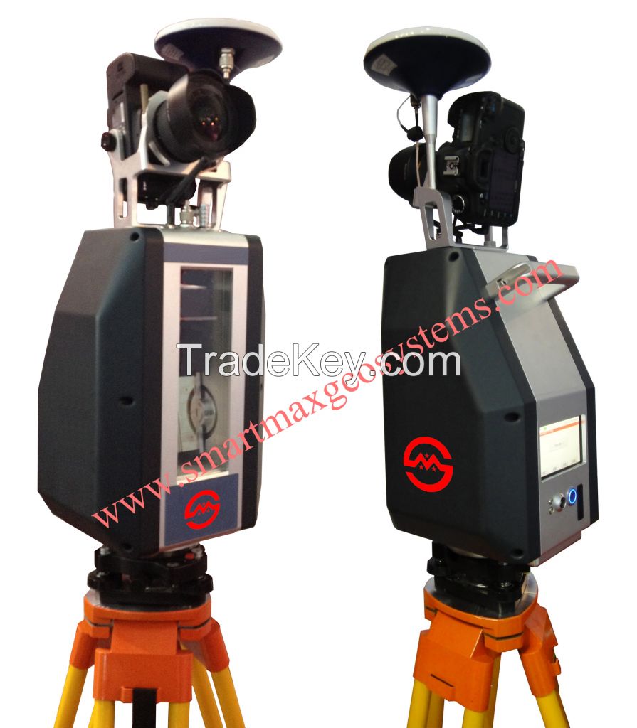
VS***0 3D Laser Scanner
|
|||||||||||||||||||||||||
| Overview | |||||||||||||||||||||||||
|
VS***0 3D Laser Scanner based on pulses ranging
principle, could quick acquire massive point cloud data
from the complex geometry of the scene, can be used in
engineering surveying , urban building surveying ,
topographic mapping , mining, deformation monitoring ,
factory / large structures / pipeline design , aircraft
and ships manufacturing, road and rail construction ,
tunneling, bridge reconstruction , water conservancy,
airport and port engineering and other fields . |
|||||||||||||||||||||||||
| Features | |||||||||||||||||||||||||
|
Effective measuring distance up to ***0 m |
|||||||||||||||||||||||||
| Specifications | |||||||||||||||||||||||||
| Instrument Type | Pulsed, High-speed, Long distance 3D laser scanner | ||||||||||||||||||||||||
| Camera |
External Canon 5D Mark II |
||||||||||||||||||||||||
| Type | VS***0 | ||||||||||||||||||||||||
|
Accuracy of single measurement(*0m) |
Position |
±1.2mm
Productos relacionados SMART MAX GEOSYSTEMS CO.,LTDProductos relacionadosSend a direct inquiry to this supplierGet Verified Buyers & SuppliersAvail Free Consultation | |||||||||||||||||||||||


